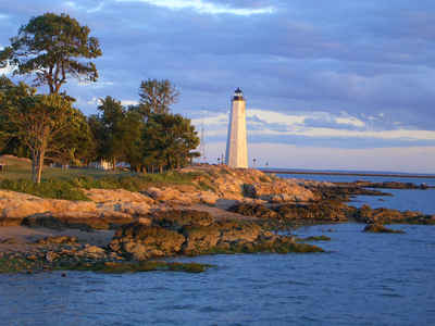
Connecticut Counties
There are currently eight Counties in Connecticut. Four of them were originally created in 1666, during the first consolidation of the colony of Connecticut. Middlesex and Tolland counties, have been created since American independence, both in 1785.Hartford County, Connecticut
Hartford County Education, Geography, and History
Hartford County is a county located in
the north central part of the state of Connecticut. Based on the 2010 census,
the population was 894,014, making it the second-most populous
county in Connecticut. Hartford County was created on May
10, 1666 and was formed as One of four original counties created in Connecticut.
The County Seat was Hartford (1666-1960).
The county was named after Hertfordshire, England.
Hartford County is included in the Hartford-West Hartford-East Hartford, CT
Metropolitan Statistical Area.
Etymology - Origin of Hartford County Name
The county is named after the county of Hertfordshire in England.
Demographics:
County QuickFacts: CensusBureau Quick Facts
Hartford County History
Hartford County is located in north central Connecticut, bordered on the west by Litchfield County, on the east by Tolland County, and to the south by New Haven and Middlesex Counties. Connecticut's first established county, it is also bordered to the north by the State of Massachusetts. The Connecticut River bisects Hartford County from north to south and has played an important role in the development of the region since colonial times. The total land area covered by Hartford County is 736 square miles.
As established in 1666, Hartford County consisted of the towns of Windsor,
Wethersfield, Hartford, Farmington, and Middletown. The "Thirty Miles Island"
referred to in the constituting Act was incorporated as the town of Haddam
in 1668. In 1670, the town of Simsbury was established, extending Hartford
County to the Massachusetts border. In the late 17th to early 18th centuries,
several more towns were established and added to Hartford County: Waterbury
in 1686 (transferred to New Haven County in 1728), Windham in 1694 (transferred
to Windham County in 1726), Hebron in 1708 (transferred to Tolland County
in 1785), Coventry in 1712 (transferred to Windham County in 1726), and Litchfield
in 1722 (transferred to Litchfield County in 1751).
In 1714, all of the unincorporated territory north of the towns of Coventry
and Windham in northeastern Connecticut to the Massachusetts border were placed
under the jurisdiction of Hartford County. Windham County was constituted
in 1726, resulting in Hartford County losing the towns of Windham, Coventry,
Mansfield (incorporated in 1702), and Ashford (incorporated in 1714). Northwestern
Connecticut, which was originally placed under the jurisdiction of New Haven
County in 1722, was transferred to Hartford County by 1738. All of northwestern
Connecticut was later constituted as the new Litchfield County in 1751. In
1785, two more counties were established in what was now the US state of Connecticut:
Tolland and Middlesex. This mostly resulted in the modern extent of Hartford
County. In the late 18th and early 19th centuries, the establishment of several
more towns resulted in minor adjustments in the bounds of the county. The
final adjustment resulting in the modern limits occurred on May 8, 1806, when
the town of Canton was established.
Geography: Land and Water
Hartford county is located close to the center of Connecticut. The county is divided into two unequal parts by the Connecticut River. Part of the river valleys are muddy and subject to flooding. Other parts of the Hartford county are hilly.
Neighboring Counties
Bordering counties are as follows:
- North: Hampden County, Mass.
- East: Tolland County
- Southeast: New London County; Middlesex County
- Southwest: New Haven County
- West: Litchfield County


