Montana Counties
There are fifty-six counties in Montana. Montana has two consolidated city-counties- Anaconda with Deer Lodge County and Butte with Silver Bow County. The portion of Yellowstone National Park that lies within Montana was not part of any county until 1997, when part of it was nominally added to Gallatin County, and the rest of it to Park County.Sanders County, Montana
Sanders County Education, Geography, and History
Sanders County is a county located in the state of Montana. Based on the 2010 census, the population was 11,413. Its county seat is Thompson Falls. The county was founded in 1905.
Etymology - Origin of Sanders County Name
Wilbur Fiske Sanders, a pioneer, vigilante, and US Senator from Montana
Demographics:
County QuickFacts: CensusBureau Quick Facts
Sanders County History
Sanders County was created 7 February 1905 from Missoula County. County seat: Thompson Falls
Geography: Land and Water
As reported by the Census Bureau, the county has a total area of 4,480 square miles (7,226 km2), of which, 4,435 square miles (7,154 km2) of it is land and 45 square miles (72 km2) of it (1.00%) is water.
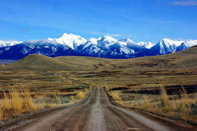
It is located on the west edge of the state of Montana, with a variety of mountains - it is part of the Coeur d'Alene Mountains in the
Bitterroot Range. The Clark Fork River runs through the middle of the county; Southeast to Northwest flow orientation with the Bitterroot
Mountains on the Southwestern side and the Cabinet Mountains to the Northeast. Like many river systems of Western Montana, the Clark Fork is
noted for broad, open plains along its banks.
It is partially arid, with the west-facing mountain slopes capturing the most rain: ranging from nearly 40 inches a year in Heron (similar to
Seattle's annual precipitation) on the Western end of the county to less than 12 inches per year in Dixon on the East end.
During the last ice age, this was the area that dammed the glacial Lake Missoula. When the ice dam broke, the resulting floods created the
Scablands in eastern Washington.
Neighboring Counties
Bordering counties are as follows:
- Lincoln County, Montana - north
- Flathead County, Montana - northeast
- Lake County, Montana - east
- Missoula County, Montana - southeast
- Mineral County, Montana - south
- Shoshone County, Idaho - west
- Bonner County, Idaho - northwest
Education


