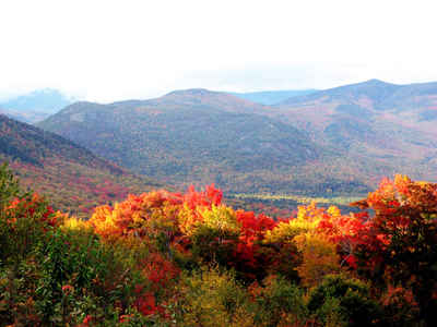
New Hampshire Counties
There are currently ten Counties in the state of New Hampshire. Five of the counties were created in 1769, when New Hampshire was still an English colony and not a state, during the first subdivision of the state into counties. The last counties created were Belknap County and Carroll County, in 1840.Cheshire County, New Hampshire
Cheshire County Education, Geography, and History
Cheshire County is a county located in the southwestern portion of the state of New Hampshire. Based on the 2010 census, the population
was 77,117. Its county seat is Keene. Cheshire was one of the five original counties of New Hampshire, and is named for the county of Cheshire
in England. It was organized in 1771 at Keene.
Cheshire County comprises the Keene, NH Micropolitan Statistical Area.
Etymology - Origin of Cheshire County Name
Cheshire County, New Hampshire: Cheshire is named for the English county of Cheshire.
Demographics:
County QuickFacts: CensusBureau Quick Facts
Cheshire County History
Cheshire County is located in the Monadnock region of southwestern New Hampshire with a total area of over 736 square miles. With 19 square miles of inland waterways, 83% forested, the county remains relatively rural in character. The county population is
72,182 with the city of Keene (population 22,872) serving as the geographical and social-economic center of the county. The town of Swanzey (population 6,653) and Jaffrey (population 5,431) are the next largest communities in Cheshire. The remaining 52% of the population resides in relatively rural
settings in the remaining 20 towns with populations ranging from 250 - 4,200. The split between those who were born in New Hampshire and those who have immigrated is about 50/50.
Cheshire County has a mix of rural villages, urban settings, forest and agricultural land, and numerous lakes and streams. The health and vigor of its diverse natural resources is an important attraction. While the economic base is industrial, business, and service oriented, tourism is very
important to the area. Monadnock State Park in Jaffrey (location of Mount Monadnock, the most heavily climbed mountain in New England), the 13,000 acre Pisgah State Park in the southwest corner of the county, and Rhododendron State Park in Fitzwilliam are significant natural attractions to the area.
Geography: Land and Water
As reported by the Census Bureau, the county has a total area of 729 square miles (1,888 km2), of which 707 sq mi (1,831 km2) is land and 22 sq mi (57 km2) (2.98%) is water. The highest point in Cheshire county is Mount Monadnock, at 3,165 feet (965 m).
Neighboring Counties
Bordering counties are as follows:
- Sullivan County (north)
- Hillsborough County (east)
- Worcester County, Massachusetts (southeast)
- Franklin County, Massachusetts (southwest)
- Windham County, Vermont (west)
Education


