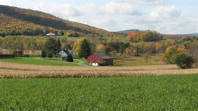
Armstrong County, Pennsylvania
Armstrong County Education, Geography, and History

Armstrong County is a county located in the state of Pennsylvania. Based on the 2010 census, the population was 68,941. The county seat is
Kittanning. The county was organized on March 12, 1800, from parts of Allegheny, Westmoreland and Lycoming Counties. It was named in honor of
John Armstrong, who represented Pennsylvania in the Continental Congress and served as a major general during the Revolutionary War.
Armstrong County is included in the Pittsburgh, PA Metropolitan Statistical Area.
Etymology - Origin of Armstrong County Name
Named for John Armstrong (October 13, 1717 - March 9, 1795), an American civil engineer and soldier who served as a major general in the Revolutionary War. He was a delegate to the Continental Congress for Pennsylvania.
Demographics:
County QuickFacts: CensusBureau Quick Facts
Armstrong County History
Created on March 12, 1800, from parts
of Allegheny, Westmoreland, and Lycoming Counties and was named for General John
Armstrong. It was attached to Westmoreland County until 1805. Kittanning, the
county seat was incorporated as a borough on April 2, 1821, and derived its name
from a Delaware Indian village at the same place.
The area saw much fighting between settlers and Indians in the French and Indian
War and Revolutionary War. John Armstrong's attack on the Indian village of
Kittanning in 1756 proved that the Indians were not invincible. The territory
was purchased from the Indians by the two Treaties of Fort Stanwix, 1768 (known
as the New Purchase) and 1784 (known as the Last Purchase). The State's third
ranked bituminous coal producing county, Armstrong also has produced glass,
clay, brick, and quarried stone. Most of the coal mines are subsurface. A brief
oil boom occurred after 1865, and natural gas was produced long afterwards.
Steel production was once important, but declined by the 1930s. Armstrong's
farming is strong in livestock and has a valuable mushroom crop. Thirty percent
of the land is farmed.
Geography: Land and Water
As reported by the Census Bureau, the county has a total area of 664 square miles (1,721 km2), of which, 654
square miles (1,694 km2) of it is land and 11 square miles (27 km2) of it (1.58%) is water.
Neighboring Counties
Bordering counties are as follows:
- Clarion County (north)
- Jefferson County (northeast)
- Indiana County (east)
- Westmoreland County (south)
- Allegheny County (southwest)
- Butler County (west)
- Venango County(northwest)
Education
Colleges and universities
Indiana University of Pennsylvania Northpointe - South Buffalo Township


