Chester County, Pennsylvania
Chester County Education, Geography, and History

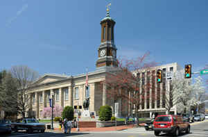
Chester County is a county located in the state of Pennsylvania. Based on the 2010 census, the population was 498,886. The county seat is
West Chester. Chester County was one of the three original Pennsylvania counties created by William Penn in 1682. It was named for Chester,
England.
Chester County is included in the Philadelphia-Camden-Wilmington, PA-NJ-DE-MD Metropolitan Statistical Area. Eastern Chester County is home to
many communities that comprise part of the Main Line western suburbs of Philadelphia, while part of its southernmost portion is considered
suburban Wilmington, along with southwest Delaware County.
Etymology - Origin of Chester County Name
It was named for Chester, the older county seat (now in Delaware County), which in turn derived its name from the shire town of Cheshire.
Demographics:
County QuickFacts: CensusBureau Quick Facts
Chester County History
One of the three original counties
formed by William Penn in November 1682. It did not become an inland county
until 1789. Its name derives from Cheshire (i.e., Chester-shire), England, from
which many of its early settlers came. West Chester, the county seat since 1788,
was incorporated as a borough on March 28, 1799. It was named for Chester, the
older county seat (now in Delaware County), which in turn derived its name from
the shire town of Cheshire.
Quakers were very influential in the early period, and an older Swedish
population that pre-dated William Penn's charter was absorbed. Chester shares
with Montgomery County the Valley Forge encampment and with Delaware County the
Brandywine Battlefield. Iron works began before the Revolution, followed by
production of paper, textiles, and bricks. Accessibility increased with the
Lancaster Pike (1795), Schuylkill Navigation Canal (1825), and Columbia Railroad
(1840s). In the 1890s the county became a residential location for commuting
Philadelphia workers. Chester was an early producer of a valuable mushroom crop,
and has long excelled in fruit growing, dairying, livestock breeding, and
raising flowers. Thirty percent of the land is farmed. The Pierre du Pont
Arboretum and Gardens arose in the nineteenth century. The institute that became
Lincoln University was founded in 1854 to educate African Americans, and there
were Underground Railroad stations at West Chester, Phoenixville, Oxford, and
Kennett Square.
Geography: Land and Water
As reported by the Census Bureau, the county has a total area of 760 square miles (1,968 km2), of which, 756
square miles (1,958 km2) of it is land and 4 square miles (10 km2) of it (0.51%) is water. The topography consists
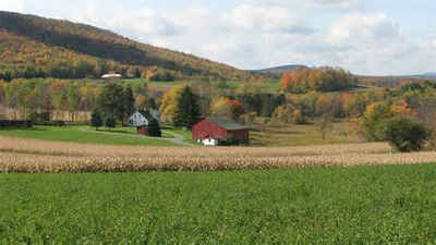
of rolling hills and valleys and it is part of the region known as the Piedmont.
Watersheds which service Chester County include the Octoraro Creek, the Brandywine Creek, the Chester Creek, and the
Schuylkill River. Many of the soils are fertile, rich loam as much as twenty-four inches thick, resulting with its
temperate climate in some of the finest farmland in the world.
Neighboring Counties
Bordering counties are as follows:
- Berks County (north)
- Montgomery County (northeast)
- Delaware County (east)
- New Castle County, Delaware (southeast)
- Cecil County, Maryland (south)
- Lancaster County (west)
Education
Colleges and universities
Cheyney University of Pennsylvania (partially in Delaware County)
Delaware County Community College (locations in Exton, Downingtown, Phoenixville and West Grove)
Immaculata University
Lincoln University
Penn State Great Valley
Valley Forge Christian College
West Chester University of Pennsylvania


