Fayette County, Pennsylvania
Fayette County Education, Geography, and History

Fayette County is a county located in the state of Pennsylvania. Based on the 2010 census, the population was 136,606. Its county seat is
Uniontown. The county was created on September 26, 1783, from part of Westmoreland County and named after the Marquis de Lafayette.
Fayette County is part of the Pittsburgh, PA Metropolitan Statistical Area.
Etymology - Origin of Fayette County Name
Named in honor of the Marie-Joseph Paul Yves Roch Gilbert du Motier, Marquis de la Fayette (or Lafayette) (6 September 1757 - 20 May 1834), a French military officer born in the province of Auvergne in south central France. Lafayette was a general in the American Revolutionary War and a leader of the Garde Nationale during the French Revolution.
Demographics:
County QuickFacts: CensusBureau Quick Facts
Fayette County History
Created on September 26, 1783, from
part of Westmoreland County and named in honor of the Marquis de la Fayette. In
1825 Lafayette visited the county as Albert Gallatin's guest and addressed the
public in Brownsville. Uniontown, the county seat, was laid out about 1776 as
Beason's-town and later renamed in allusion to the Federal Union. It was
incorporated as a borough on April 4, 1796 and as a city on December 19, 1913.
Wendell Brown and Christopher Gist settled in the area around 1752. Washington's
Fort Necessity campaign occurred in 1754, and Braddock's army passed through the
next year. Indian raids continued until 1783. Brownsville developed from a
military post, Fort Burd. From 1818 to 1852 the National or Cumberland Road
brought prosperity, ending when the Pennsylvania Railroad connected with
Pittsburgh and bypassed Fayette. The first iron furnace was fired in 1789.
Brownsville was an early boat building center, and the glass industry originally
flourished in the county. The coke industry began with the first beehive oven in
1841. Connellsville coking coal had superior chemical qualities. Henry Clay
Frick's fortune began with coke in 1870. By the 1920s, beehive ovens were
obsolete and much of the coke manufacturing moved to the sites of the steel
mills, but beehives were revived in World War II. By 1950 the coal under the
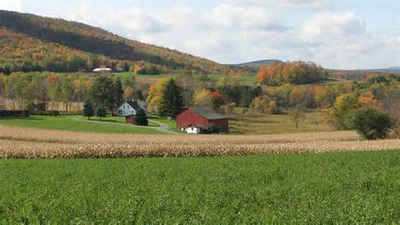
county was gone, and severe unemployment and depression began. Farms cover 23
percent of the county's land today. Bituminous coal, mined entirely by surface
operations, is still produced.
Geography: Land and Water
As reported by the Census Bureau, the county has a total area of 798 square miles (2,067 km2), of which, 790
square miles (2,046 km2) of it is land and 8 square miles (20 km2) of it (0.98%) is water. Many coal mines are
located within the county.
Neighboring Counties
Bordering counties are as follows:
- Westmoreland County (north)
- Somerset County (east)
- Garrett County, Maryland (southeast)
- Preston County, West Virginia (south)
- Monongalia County, West Virginia (southwest)
- Greene County (west)
- Washington County (northwest)
Education
Colleges and universities
Penn State Fayette, The Eberly Campus is a Commonwealth Campus of the Pennsylvania State University system located in Lemont Furnace. Penn State Fayette is the only four-year (bachelors) degree granting institution in Fayette County.
Public school districts
Albert Gallatin Area School District
Belle Vernon Area School District (also in Westmoreland County)
Brownsville Area School District (also in Washington County)
Connellsville Area School District
Frazier School District
Laurel Highlands School District
Southmoreland School District (also in Westmoreland County)
Uniontown Area School District


