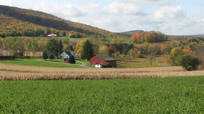
Lycoming County, Pennsylvania
Lycoming County Education, Geography, and History

Lycoming County is a county located in the Commonwealth of Pennsylvania. Based on the 2010 census, the population was 116,111.Its county seat is
Williamsport.
Lycoming County comprises the Williamsport, PA Metropolitan Statistical Area.
Etymology - Origin of Lycoming County Name
The name is derived from a Delaware Indian word meaning "sandy or gravelly creek."
Demographics:
County QuickFacts: CensusBureau Quick Facts
Lycoming County History
Created on April 13, 1795, from part
of Northumberland County and named for Lycoming Creek. The name is derived from
a Delaware Indian word meaning "sandy or gravelly creek." Williamsport, the
county seat was laid out in 1795, incorporated as a borough on March 1, 1806,
and became a city on January 15, 1866. There are various theories about the
origin of the city's name: that it was so called for Judge William Hepburn; that
Michael Ross named it for his own son William; or that William Ross, a boatman,
used it as a port years before the town was founded.
Native American groups had many communities in this area. Part of the county was
obtained by Pennsylvania from Indians at the Fort Stanwix Treaty of 1768 and the
remainder at Fort Stanwix in 1784 (the "Last Purchase"). A mapping ambiguity in
the 1768 deed left an independent settlement area- a "no-man's land"- known as the
"Fair Play tract" which lasted until the 1784 deed clearly made it
Pennsylvania's land. Heroic fighting against Native Americans occurred during
the Revolution, especially the exploits of the Bradys. Lumber was the backbone
of the economy from the start. There was good access from major roads, and the
West Branch Canal reached to Williamsport in 1833, but production really soared
after the Susquehanna Boom was built at Williamsport, between 1846 and 1851,
giving greater control over the lumber that was floated down river to its
markets. A "Millionaires Row" of houses arose in Williamsport. But the 1889
flood destroyed the boom, much of Williamsport, and all the sawmills. A paper
box industry later rose, relying on wood pulp, and Muncy became a manufacturing
center. Today, Williamsport makes electronics and metal products. Only one-fifth
of the county is farmed, largely along the river, but Lycoming is in the upper
half of Pennsylvania counties in value of total farm products. Dairy products
and mushrooms are the specialties of greatest economic value.
Geography: Land and Water
As the crow flies, Lycoming County is about 130 miles (209 km) northwest of Philadelphia and 165 miles (266 km)
east-northeast of Pittsburgh. As reported by the Census Bureau, the county has a total area of 1,244 square miles
(3,221 km2).1,235 square miles (3,198 km2) of it is land and 9 square miles (23 km2) of it (0.72%) is water.
Lycoming County is the largest county in terms of area in Pennsylvania, and is larger than the state of Rhode
Island.
Neighboring Counties
Bordering counties are as follows:
- Tioga County (north)
- Bradford County (northeast)
- Sullivan County (east)
- Columbia County (southeast)
- Montour County (south)
- Northumberland County (south)
- Union County (south)
- Clinton County (west)
- Potter County (northwest)
Education
Colleges
Lycoming College
Newport Business Institute
Pennsylvania College of Technology
Public school districts
Canton Area School District (also in Bradford and Tioga Counties) Canton Warriors
East Lycoming School District Hughesville Spartans
Jersey Shore Area School District (also in Clinton County) Jersey Shore Bulldogs
Loyalsock Township School District Loyalsock Lancers
Montgomery Area School District Montgomery Red Raiders
Montoursville Area School District Montoursville Warriors
Muncy School District Muncy Indians
South Williamsport Area School District South Williamsport Mountaineers
Southern Tioga School District (also in Tioga County) Liberty Mountaineers, Mansfield Tigers, and North Penn Panthers
Wellsboro Area School District (also in Tioga County) Wellsboro Hornets
Williamsport Area School District Williamsport Millionaires


