Montgomery County, Pennsylvania
Montgomery County Education, Geography, and History

Montgomery County, locally also referred to as Montco, is a county located in the Commonwealth of Pennsylvania. Based on the 2010 census, the
population was 799,874, making it the third-most populous county in Pennsylvania, after Philadelphia and Allegheny Counties. The county seat
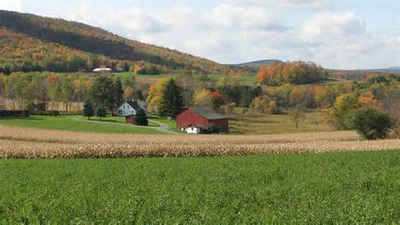
is Norristown. Montgomery County is very diverse, ranging from farms and open land in Upper Hanover to densely populated rowhouse streets in
Cheltenham.
Montgomery County is included in the Philadelphia-Camden-Wilmington, PA-NJ-DE-MD Metropolitan Statistical Area. It is a suburban county
northwest of Philadelphia, and marks the region's northern border, with the Lehigh Valley region of the state to the north.
Etymology - Origin of Montgomery County Name
Named perhaps for Montgomeryshire in Wales, for the Revolutionary hero Gen. Richard Montgomery, or for two legislators named Montgomery who advanced the bill to create the county.
Demographics:
County QuickFacts: CensusBureau Quick Facts
Montgomery County History
Created on September 10, 1784 from
part of Philadelphia County. Named perhaps for Montgomeryshire in Wales, for the
Revolutionary hero Gen. Richard Montgomery, or for two legislators named
Montgomery who advanced the bill to create the county. Norristown, the county
seat, was laid out in 1784 and incorporated as a borough on March 31, 1812. It
was named for Isaac Norris who owned land there.
Settled since 1685, the first residents were Germans, mainly pietists, in
Germantown. Welsh, Scotch-Irish, English (mostly Quakers), and Swedes flocked to
the area. The opening of the Schuylkill Canal in 1825 boosted the economy,
followed by railroads. The Pennsylvania Railroad's Main Line passed through in
the 1860s, giving rise to an elite residential area, "the Main Line."
Intelligent farming has always been practiced on the county's good soil. Iron
works arose in Norristown, Pottstown, and Conshohocken, and leather tanning was
very important until the 1930s. Bernard McCready began a large textile factory
in Norristown in 1826, with an enormous factory. Cigars, carriages, and paper
were nineteenth-century Montgomery specialties, and marble is still quarried.
From about 1900 to the 1970s steel, machinery, textiles, rubber, electrical,
chemicals, and paint manufacturing were strong. The county is still a
manufacturing giant. In 1992 it had the highest "value added from manufactures"
figure of any Pennsylvania county. This was an amazing 9 ¼ billion dollars- more
than double the figure for any other county. In addition, much personal income
comes in from residents who work in Philadelphia. The county has the highest
personal income rate and lowest percentage in poverty of the sixty-seven
counties. Eighteen percent of the land is still farmed, and the county ranks
eleventh in cash receipts from field crops. Both Republican Gov. Hartranft and
Democratic presidential candidate Winfield Scott Hancock were natives.
Geography: Land and Water
As reported by the Census Bureau, the county has a total area of 487 square miles (1,262 km2), of
which, 483 square miles (1,251 km2) of it is land and 4 square miles (11 km2) of it (0.89%) is water.
Neighboring Counties
Bordering counties are as follows:
- Lehigh County (north)
- Bucks County (northeast)
- Philadelphia County (southeast)
- Delaware County (southwest)
- Chester County (west)
- Berks County (northwest)
Education
Colleges and universities
Arcadia University
Bryn Athyn College
Bryn Mawr College
DeVry University – Fort Washington
Gwynedd Mercy University
Haverford College
Manor College
Montgomery County Community College
Pennsylvania College of Optometry (Salus University)
Penn State Abington – a commonwealth campus of Pennsylvania State University
Rosemont College
St. Charles Borromeo Seminary
Saint Joseph's University
Temple University – Ambler
Ursinus College
Westminster Theological Seminary


