Northampton County, Pennsylvania
Northampton County Education, Geography, and History

Northampton County is a county located in the state of Pennsylvania. Based on the 2010 census, the population was 297,735. Its county seat
is Easton. The county was formed in 1752 from parts of Bucks County. Its namesake was Northamptonshire and the county seat of Easton is named
for the country house Easton Neston.
Northampton County is included in the Allentown-Bethlehem-Easton, PA-NJ Metropolitan Statistical Area, which is also included in the New
York-Newark, NY-NJ-CT-PA Combined Statistical Area. Its northern edge borders The Poconos, and its eastern section borders the Delaware River,
which divides Pennsylvania and New Jersey.
Etymology - Origin of Northampton County Name
Named for Northamptonshire, England, where Thomas Penn's father-in-law, the Earl of Pomfret, lived.
Demographics:
County QuickFacts: CensusBureau Quick Facts
Northampton County History
Created on March 11, 1752 from parts
of Bucks County and named for Northamptonshire, England, where Thomas Penn's
father-in-law, the Earl of Pomfret, lived. Easton, the county seat was named for
the Earl's estate. It was incorporated as a borough on September 23, 1789 and
became a city on November 2, 1886. The county adopted a home rule charter in
April 1976.
Pennsylvania's Walking Purchase from the Delaware Indians in 1737 included all
the present area of this county. Moravians settled in 1740 at Nazareth and in
1741 at Bethlehem. Fries' Rebellion against a federal tax on windows occurred
here. Until 1800 Northampton was the entire northeastern section of
Pennsylvania. In 1812 the creation of Lehigh County divided the Lehigh Valley,
and Northampton continued to yield land until the formation of Carbon County in
1843. German farmers from Bucks County and Perkiomen Valley, as well as
Scots-Irish from New Castle, were the first settler groups. The opening of the
Lehigh Canal in 1829 triggered industrial growth. Major iron works functioned at
Easton, Glendon, and South Bethlehem before 1860. Bethlehem Iron Works became
Bethlehem Steel, the second largest United States' steel producer. By 1890 there
were also flour mills, textile factories, slate quarries, and zinc mines.
Depression was seriously felt from 1930 to 1941. Bethlehem Steel recognized the
United Steelworkers in 1939, but there was a bitter strike in 1941. Lasting
industrial decline began in 1955, reaching beyond the steel industry. The cement
mills and the Dixie Cup Company have closed. Farms cover 36 percent of the
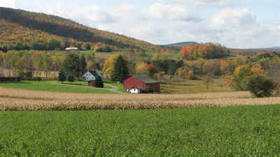
county and Northampton is a significant grain and peaches producer.
Geography: Land and Water
As reported by the Census Bureau, the county has a total area of 377 square miles (977 km2), of which, 374
square miles (968 km2) of it is land and 4 square miles (9 km2) of it (0.94%) is water.
Neighboring Counties
Bordering counties are as follows:
- Monroe County (north)
- Warren County, New Jersey (east)
- Bucks County (south)
- Lehigh County (west)
- Carbon County (northwest)
Education
Colleges and universities
Lafayette College, Easton.
Lehigh University, Bethlehem.
Moravian College, Bethlehem.
Northampton County Area Community College, Bethlehem Township.
Respect Graduate School, Bethlehem.


