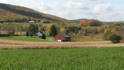
Potter County, Pennsylvania
Potter County Education, Geography, and History

Potter County is a county located in the state of Pennsylvania. Based on the 2010 census, the population was 17,457, making it the
fifth-least populous county in Pennsylvania. Its county seat is Coudersport. The county was created in 1804 and later organized in 1836. It is
named after James Potter, who was a general from Pennsylvania in the Continental Army during the American Revolution. Though it is named for
him, James Potter never actually lived in Potter County and may have never even visited the area.
Potter County is located in the Allegheny Plateau region.
Etymology - Origin of Potter County Name
Named for General James Potter of Cumberland and later Northumberland Counties
Demographics:
County QuickFacts: CensusBureau Quick Facts
Potter County History
Created on March 26, 1804 from part
of Lycoming County and named for General James Potter of Cumberland and later
Northumberland Counties, hero of both the French and Indian and Revolutionary
Wars, and a member of the Supreme Executive Council and the Council of Censors.
It was attached to Lycoming County until 1814 when it was authorized to elect
commissioners jointly with McKean County. McKean and Potter Counties were
separated in 1824, but Potter was still attached to McKean for judicial
purposes. It was fully organized in 1835. Coudersport, the county seat, was laid
out in 1807 and incorporated as a borough on February 7, 1848. It was named for
Jean Samuel Couderc, an Amsterdam banker.
An uninhabited section of overly large Lycoming County, the county was created
by the legislature on the same day as McKean and Tioga, to reduce Lycoming
County to manageable size. John Keating of Philadelphia owned and developed much
of the area. Many early settlers were New Englanders who came from New York;
there were only twenty-three residents in 1810. The east-west road across the
county sparked commercial progress. A lumber economy led to a population peak of
30,621 in 1900, but then it declined as the forests disappeared. A Norwegian
colony started by utopian violinist Ole Bull failed in 1852-53. Before 1860
farmer-lumbermen using small water mills cut most of the lumber in northern
section. The virgin white pines were all gone by 1880. Commercial lumbering
began in 1837 at Millport. Goodyear Brothers of Buffalo, N.Y. started a second
lumber boom in 1884, using railroads and power mills. There was a large tannery
at Costello in 1886. Galeton, acquired by the Goodyears, had railroad shops, a
tannery, a sawmill, and a brewery. The western section was exploited by a
Scranton based company, which did not diversify as Galeton had. It died when the
trees were gone, in 1912. Most of the tanneries closed before 1930. Acetate,
charcoal, wood alcohol, wood tar were produced from small hardwoods until about
1950. Gas, discovered after 1900, led to glass manufacture that lasted a few
decades. Deep gas, discovered in the 1930s, was piped out and sold elsewhere.
Today there is some dairy farming in the north, and potatoes have grown well
since the 1920s; farms occupy 14 percent of the land. Carbon is now produced.
The Bayless Paper Company, begun in 1901 near Austin, did well until its dam
burst in 1911. Rebuilt, it carried on until a 1942 flood destroyed it again.
Geography: Land and Water
As reported by the Census Bureau, the county has a total area of 1,081 square miles (2,801 km2), of which,
1,081 square miles (2,800 km2) of it is land and 0 square miles (1 km2) of it (0.02%) is water.
Neighboring Counties
Bordering counties are as follows:
- Allegany County, New York (north)
- Steuben County, New York (northeast)
- Tioga County (east)
- Lycoming County (southeast)
- Clinton County (south)
- Cameron County (southwest)
- McKean County (west)
Education
Public school districts
Austin Area School District
Coudersport Area School District
Galeton Area School District (also in Tioga County)
Keystone Central School District (also in Clinton County)
Northern Potter School District
Oswayo Valley School District (also in McKean County)
Port Allegany School District (also in McKean County)


