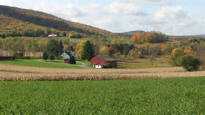
Somerset County, Pennsylvania
Somerset County Education, Geography, and History

Somerset County is a county located in the state of Pennsylvania. Based on the 2010 census, the population was 77,742. Its county seat is
Somerset. The county was created on April 17, 1795, from part of Bedford County and named after Somerset, United Kingdom.
Somerset County comprises the Somerset, PA Micropolitan Statistical Area, which is included in the Johnstown-Somerset, PA Combined Statistical
Area.
Etymology - Origin of Somerset County Name
Named for Somersetshire, England.
Demographics:
County QuickFacts: CensusBureau Quick Facts
Somerset County History
Created on April 17, 1795, from part
of Bedford County and named for Somersetshire, England. Somerset, the county
seat was laid out in 1795 and incorporated as a borough on March 5, 1804.
Traversed by the Forbes Road in 1758, it became legal to settle the Somerset
area after the "New Purchase" of 1768. German Brethren groups from New Jersey
settled Brothers Valley, and the radical preacher Harmon Husband joined them in
1771. A rye and whiskey economy involved the area in the Whiskey Rebellion in
1794 against the federal government's tax on distilleries. Although punished,
Husband, who died June 1795, saw the county created that April. Robert Philson,
also a Whiskey leader, lived on as Somerset's political leader. More land was
added in 1800, but some was yielded to create Cambria County in 1804. An
Agricultural Society was formed in 1828 to pursue intelligent farm methods.
Cattle and sheep were very productive, and the cloth called linsey-woolsey was
manufactured. Maple sugar was important. There was a severe frost in 1859, when
only the buckwheat crop prevented starvation. Although coal had been mined and
timber cut since 1770s, only when the Somerset and Cumberland Railroad opened in
1871 were big lumber and coal industries developed. Large mines began in 1872,
and later a branch of the B. & O. Railroad opened the northern coal section.
Babcock Lumber Company flourished until the lumber was gone in 1912. The
population had mushroomed. Peak coal production occurred in 1920- 10.5 million
tons! There were violent coal strikes in 1903, 1906, and 1922. Coal production
fell off sharply, but dairying and potato production increased in the 1920s. The
1936 flood eliminated the old wooden miners' houses. The peak population
occurred in 1940 (84,957), the same year the Pennsylvania Turnpike appeared and
saved the county's economy. Today there is heavy production of hay, oats, milk,
potatoes, and alfalfa; one third of the county is farmland. Potato chips are
produced, and tourism, especially skiing, is important. When US 219 opened
from Ebensburg to Somerset in 1969, it augmented the Turnpike by providing a
north-south artery. Somerset is now the second highest bituminous producing
county.
Geography: Land and Water
As reported by the Census Bureau, the county has a total area of 1,081 square miles (2,800 km2), of which,
1,075 square miles (2,783 km2) of it is land and 7 square miles (17 km2) of it (0.60%) is water.
Neighboring Counties
Bordering counties are as follows:
- Cambria County (north)
- Bedford County (east)
- Allegany County, Maryland (southeast)
- Garrett County, Maryland (southwest)
- Fayette County (west)
- Westmoreland County (northwest)
Education
Public school districts
Berlin Brothersvalley School District
Conemaugh Township Area School District
Meyersdale Area School District
North Star School District
Rockwood Area School District
Salisbury-Elk Lick School District
Shade-Central City School District
Shanksville-Stonycreek School District
Somerset Area School District
Turkeyfoot Valley Area School District
Windber Area School District (also in Cambria County)


