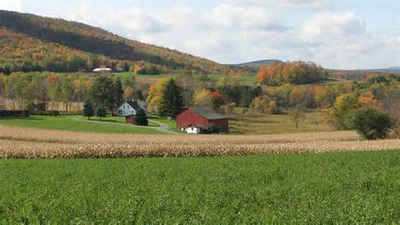
Washington County, Pennsylvania
Washington County Education, Geography, and History

Washington County is a county located in the state of Pennsylvania. Based on the 2010 census, the population was 207,820. Its county seat is
Washington. The county was created on March 28, 1781, from part of Westmoreland County. Both the county and the city were named for American
Revolutionary War leader George Washington, later to become the first President of the United States.
Washington County is included in the Pittsburgh Metropolitan Statistical Area.
Etymology - Origin of Washington County Name
Named in honor of George Washington.
Demographics:
County QuickFacts: CensusBureau Quick Facts
Washington County History
Created on March 28, 1781 from part
of Westmoreland County and named in honor of George Washington. Washington, the
county seat, was laid out in 1781, incorporated as a borough on February 12,
1810, and chartered as a city in 1924.
Indian ownership was yielded to Pennsylvania by the "New Purchase" deed at Ft.
Stanwix in 1768, but Virginia claimed southwestern Pennsylvania (all the way to
Pittsburgh) until she yielded the argument in 1780. Scots-Irish led by three
Presbyterian clergy, founded Buffalo, Amity, and Canonsburg, about 1775. One,
the Rev. John McMillan, became a strong political leader. Indian raids lasted
until the 1790s. This was a center of the Whiskey Rebellion (1794), of which
David Bradford was the leader, but after that distilling declined. In time,
sheep created prosperity, increasingly so with the spread of the efficient
Merino breed between 1820 and 1840. The National Road led to the founding of
Centerville, Claysville, and Beallsville, but the arrival of the Pennsylvania
Railroad in Pittsburgh, in 1852, eclipsed the prosperity that the National
Road's wagon route had stimulated. The opening of US Route 40 early in the
twentieth century benefited Washington. Small railroads entered the county in
the 1850s; coal mining grew after 1865 and the county is still one of the major
coal producers. Natural gas was harnessed for sale in 1884, the same year oil
was struck. Small steel mills began around 1900, and a glass industry flourished
from the 1880s to the 1950s. Steel processing, steel products, and other metal
products are strong businesses in the county. Today, Washington rivals Greene as
top producing county for sheep and wool. Forty percent of the land is farmed,
and the county is a significant producer of apples, cattle, and alfalfa and
forage crops.
Geography: Land and Water
As reported by the Census Bureau, the county has a total area of 861 square miles (2,230 km2).857 square miles
(2,220 km2) of it is land and 4 square miles (10 km2) of it (0.45%) is water.
Neighboring Counties
Bordering counties are as follows:
- Beaver County (north)
- Allegheny County (northeast)
- Westmoreland County (east)
- Fayette County (southeast)
- Greene County (south)
- Marshall County, West Virginia (southwest)
- Ohio County, West Virginia (west)
- Brooke County, West Virginia (west)
- Hancock County, West Virginia (northwest)
Education
Colleges and universities
California University of Pennsylvania in California Borough
Community College of Allegheny County Washington branch in North Franklin Township
Washington & Jefferson College in the City of Washington and East Washington Borough
Waynesburg University- Southpointe Center Campus in Canonsburg.
Public school districts
Avella Area School District
Bentworth School District
Bethlehem-Center School District
Brownsville Area School District (also in Fayette County)
Burgettstown Area School District
California Area School District
Canon-McMillan School District
Charleroi School District
Chartiers-Houston School District
Fort Cherry School District (also in Allegheny County)
McGuffey School District
Peters Township School District
Ringgold School District
Trinity Area School District
Washington School District
Served by
Intermediate Unit 1 – Coal Center
Mon Valley Career and Technology Center – Charleroi
Western Area Career and Technology Center – Canonsburg


