Vermont Counties
There are fourteen counties in Vermont. Each county has a county seat, known in Vermont as shire town. In 1777, Vermont had two counties. The western side of the state was called Bennington County and the eastern was called Cumberland County. In 1781 Cumberland County was broken up into three counties in Vermont, plus Washington County, which eventually became part of New Hampshire. Today's Washington County was known as Jefferson County until 1814. Essex County, Orleans County, and Caledonia County are commonly referred to as the Northeast Kingdom.Essex County, Vermont
Essex County Education, Geography, and History

Essex County is the county located in the northeastern part of the state of Vermont. Based on the 2010 census, the population was 6,306,
making it the least-populous county in both Vermont and New England. Its shire town is Guildhall. The county was created in 1792 and organized
in 1800.
Essex County is part of the Berlin, NH–VT Micropolitan Statistical Area.
Etymology - Origin of Essex County Name
Meaning of County Name
Demographics:
County QuickFacts: CensusBureau Quick Facts
Essex County History
Prior to the arrival of colonists of European descent, the local Abenakis had subsisted largely on moose.
Vermont was divided into two counties in March, 1778. In 1781 the legislature divided the northernmost county, Cumberland, into three
counties: Windham and Windsor, in approximately the modern location for those counties. The northern remainder was called Orange County. This
latter tract nearly corresponded with the old New York county of Gloucester, organized by that province March 16, 1770, with Newbury as the
shire town.
Essex County is one of 14 counties in Vermont. Its shire town is Guildhall. On September 3, 1783, as a result of the signing of the Treaty of Paris the Revolutionary War ended with Great Britain recognizing the independence of the United States. Vermont's border with Quebec was established at 45 degrees north latitude
On November 5, 1792, the legislature divided Chittenden and Orange counties into six separate counties, as follows: Chittenden, Orange, Franklin, Caledonia, Essex, and Orleans. No reason is given for the county being named after the county of Essex in England.
Guildhall is the chief town. This county is bounded north by Canada, east and south by Connecticut River, which separates it from Coos County, New Hampshire, south-west by Caledonaia County, and west by Orleans County. It is about forty-five miles long from north to south, and twenty-three broad
from east to west.
This county is the least populous in the State, with the exception of Grand Isle County. There are some towns which are entirely destitute of inhabitants. The settlements are mostly confined to the towns lying along Connecticut River. The county is in general very uneven and the soil rock and
unproductive. It comprehends that part of the county called Upper Coos, which lies on the west side of Connecticut River. Nulhegan River is the principal stream, which is wholly within the county. This and several smaller tributaries, of the Connecticut, water all of the eastern parts. Passumpsic
and Moose River, rise in the south-western part, and Clyde River and several streams, which run off to the north into Canada, water the north-western parts. Essex County presents a great variety of magnificent scenery.
Geography: Land and Water
As reported by the Census Bureau, the county has a total area of 674 square miles (1,745 km2), of which, 665 square miles (1,723 km2) of it is land and 9 square miles (22 km2) of it (1.27%) is water.
The Connecticut River watershed includes the Moose and Nulhegan rivers as well as
Paul Stream. Maidstone Lake and Great Averill and Island ponds are among the numerous small lakes. Recreational
areas include Maidstone and Brighton state parks, Victory State Forest, and Brighton Municipal Forest. Essex is one
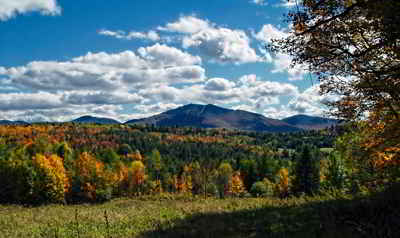
of the most heavily forested counties in Vermont, with an abundance of spruce, fir, birch, and maple trees. The
region also features many species of wildlife, notably moose.
Neighboring Counties
Bordering counties are as follows:
- Coos County, New Hampshire - east
- Grafton County, New Hampshire - south
- Caledonia County, Vermont - southwest
- Orleans County, Vermont - west
- Coaticook Regional County Municipality, Quebec - north
Education


